The National Hurricane Center has started publishing advisories on Tropical Depression No. 8. Based on the latest advisory, the NHC continues to show possible landfall near Matagorda Bay as a Tropical Storm. Tropical Storm Watches have been issued for much of the Texas Coast.

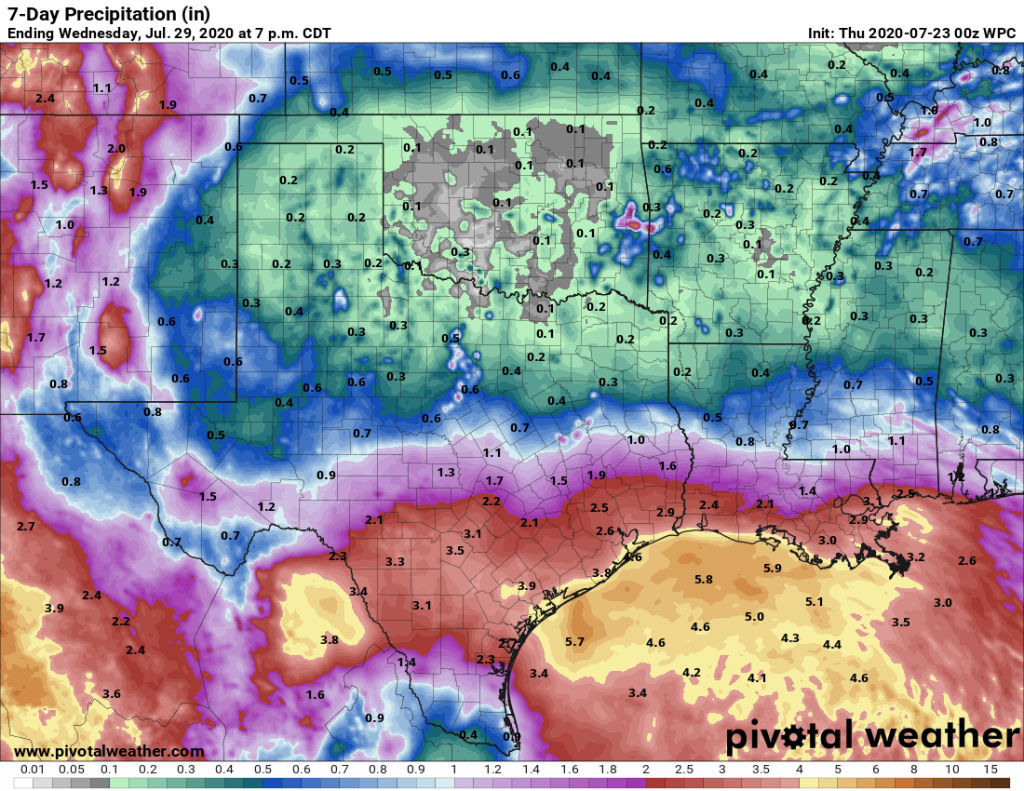
There has not been a significant change in the overall forecast since earlier today. Heavy rains are possible but will be dependent upon the final development and landfall. The current 7-Day Quantitative Precipitation Forecast (QPF) is showing widespread rainfall amounts between 2 to 4 inches across the Region, but we could see areas with isolated higher amounts.
In addition to TD No. 8, the NHC is continuing to monitor TS Gonzalo. It is still too early to determine the impacts to the Texas Coast, but the NHC expects Gonzalo to become a Hurricane on Thursday but should lose some strength returning to a Tropical Storm on Saturday as it move through the Lesser Antilles and continues south of the Dominican Republic.

We will continue to monitor the conditions and changes in the forecast, but we encourage everyone to stay informed by visiting your favorite local weather source, including the National Weather Service, the National Hurricane Center, and West Gulf River Forecast Center. If you have not ready down so, please remember to sign up for Emergency Updates from Fort Bend County and/or Harris County.
Now is a great time to review your personal Hurricane Prepardness plans and kits. See the images from Commissioner DeMerchant’s Office that were posted earlier today, but you can also visit Ready.gov for more information.


